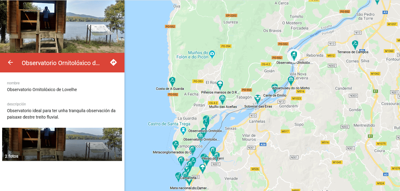
People who want to visit the municipalities along the Minho now have an interactive digital map of the River Minho that makes it easier to locate the main points of interest in the cross-border territory.
Through this tool, created by the AECT Rio Minho, users can select different locations and access a brief description of some of the natural heritage elements of the Galician municipalities of A Guarda, O Rosal, Tomiño, Tui, Salvaterra de Miño, As Neves, Arbo and Crecente, and the Portuguese municipalities of Caminha, Vila Nova de Cerveira, Valença, Monção and Melgaço. By clicking on each of the icons on the map, the position of the elements appears along with the option of “how to get there”.
Discover the natural heritage of the cross-border River Minho territory
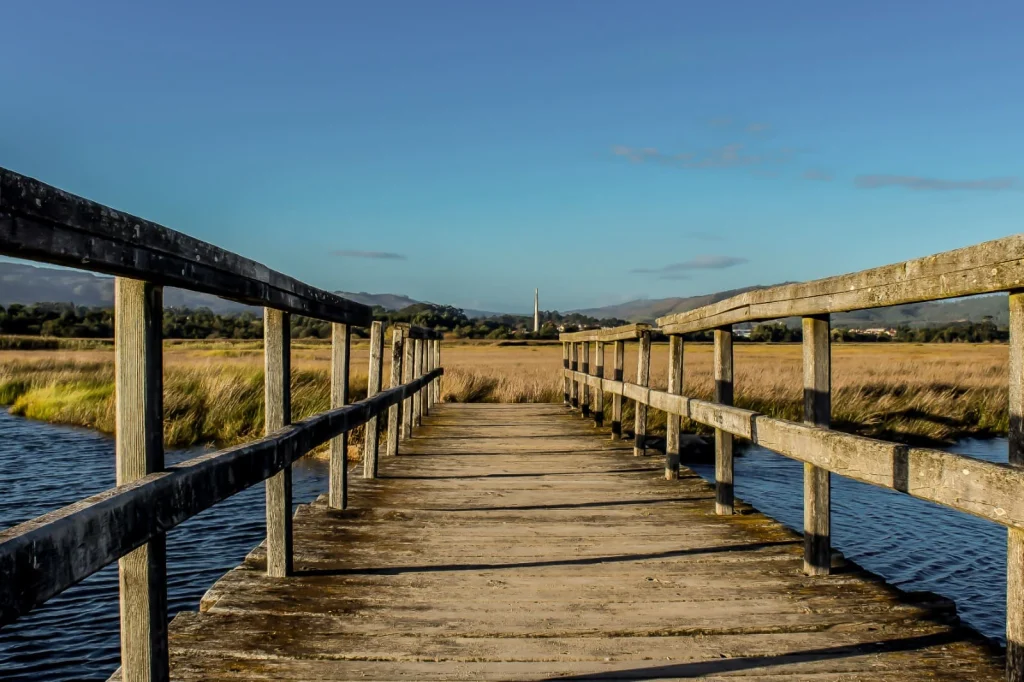
Both in the Galician and Portuguese territories, from its upper section to the river mouth, residents and visitors can identify numerous spaces that this digital map highlights and describes.
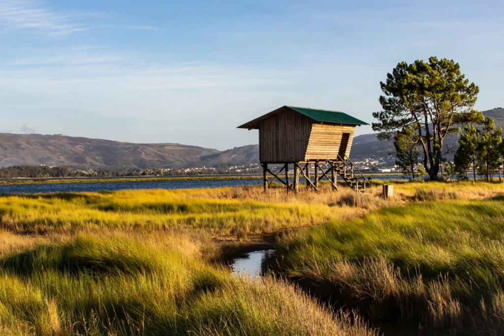
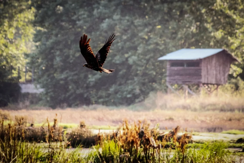
Nature reserves such as the Peneda-Gerês National Park or the Troncoso River reserve, bird observatories such as O Forno do Duque or the Salcidos observatory in Baixo Miño, traditional landscapes or astronomical observation points are just some of the natural attractions found along the river. Also included are very unique spaces such as dragonfly observation points, gardens, unique trees, geological formations, or other elements of interest, up to a total of 55.
A space of great identity value, with maximum protection due to its uniqueness in terms of landscape, flora, and fauna
According to the Deputy for Cross-Border Cooperation and Deputy Director of the AECT, Uxío Benítez, the River Minho is an ecological protection area of European scope thanks to the Natura 2000 Network.
He emphasizes that it is necessary to highlight and promote the territory and its natural heritage, and to take advantage of its potential, now also through this map which will allow visitors to locate the most unique and even unknown points, as well as create routes.
“We have a space of great identity value, with maximum protection due to its uniqueness in terms of landscape, flora, and fauna, which we can develop through ecotourism. The river is strategic for the development of the entire cross-border area.”
The interactive map, which can be consulted at https://cutt.ly/5hZUl9T, is an initiative of the VISIT RIO MINHO project, co-financed with ERDF funds through the Interreg Spain-Portugal (POCTEP) 2014-2020 program, created with the aim of enhancing the tourism and natural potential of the cross-border territory.